Research
My research integrates remote sensing, GIS, and deep learning, supported by field and laboratory measurements, to investigate diverse landscapes across terrestrial and marine environments, including forests, tidal wetlands, coastal oceans, and their interactions. I aim to understand the key drivers of landscape formation and evolution, and how these systems respond to climate change and human activities.
Coastal Geomorphology, Remote Sensing & Geographic Information Science (GIS)
Tidal Marsh, Suspended Sediments, Blue Carbon | Forest, Tree Sepecies, Tree Crown, Foilar Nutrients
Remote Sensing of COASTAL WATER
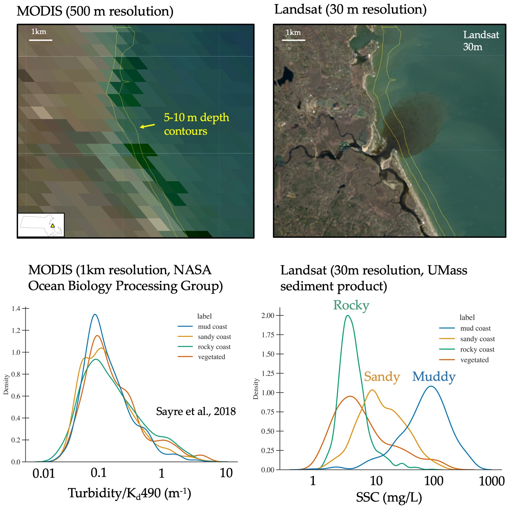
High Spatial-Resolution Satellite Mapping of Suspended Particulate Matter in Global Coastal Waters Using Particle Composition-Adaptive Algorithms
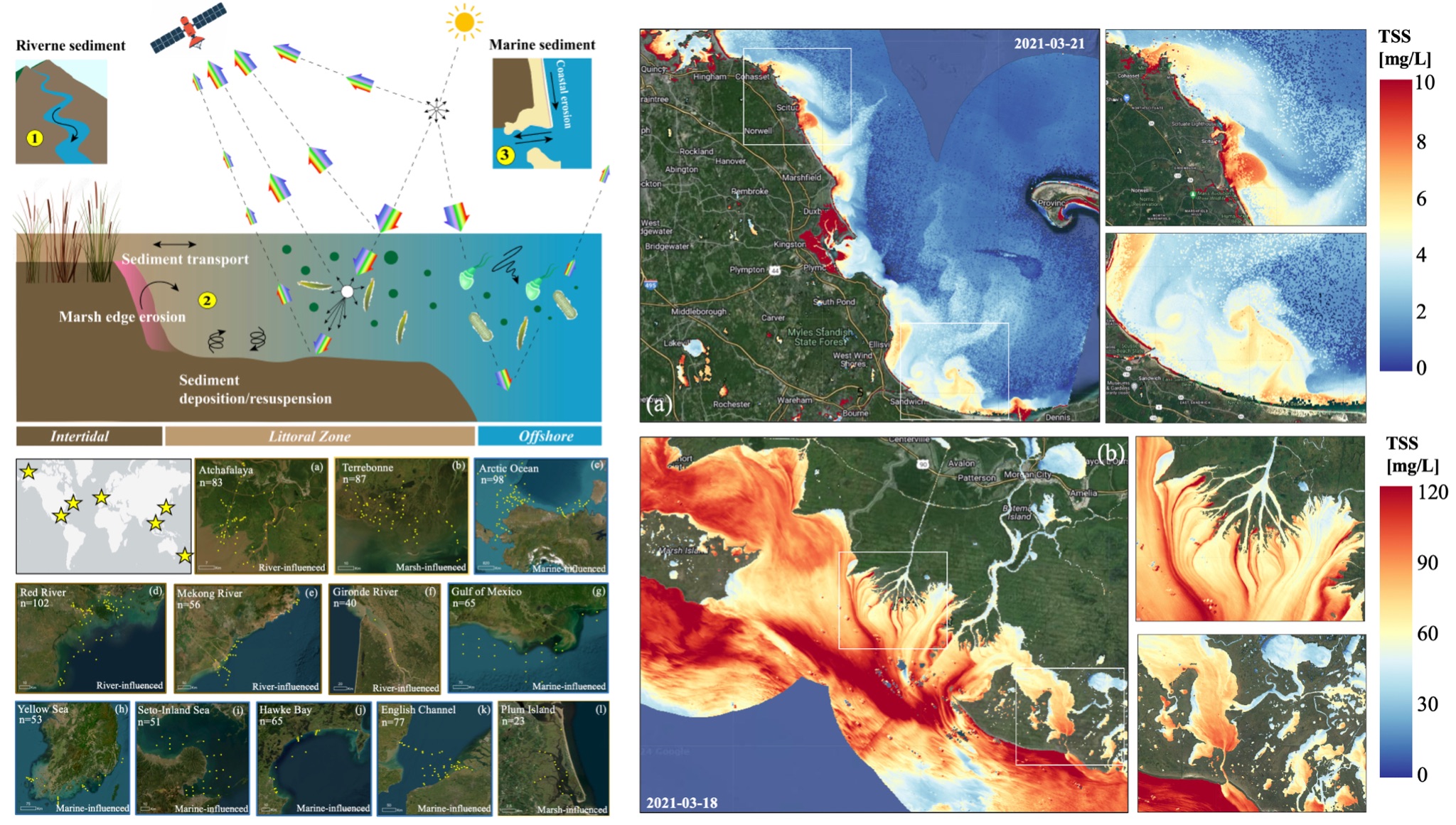
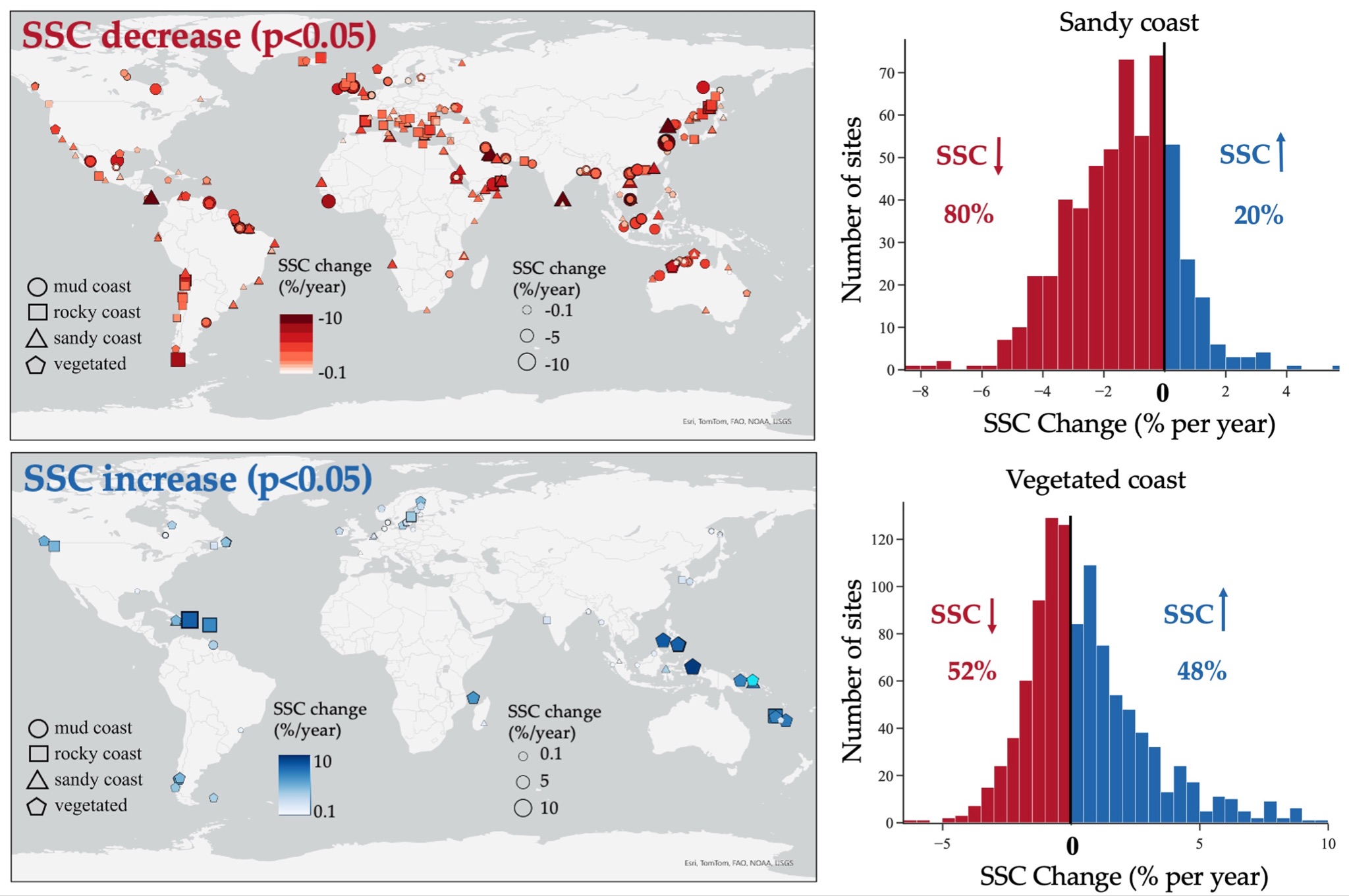
Decline in Coastal Suspended Sediments Worldwide: Insights from High-Resolution Ocean Color Remote Sensing
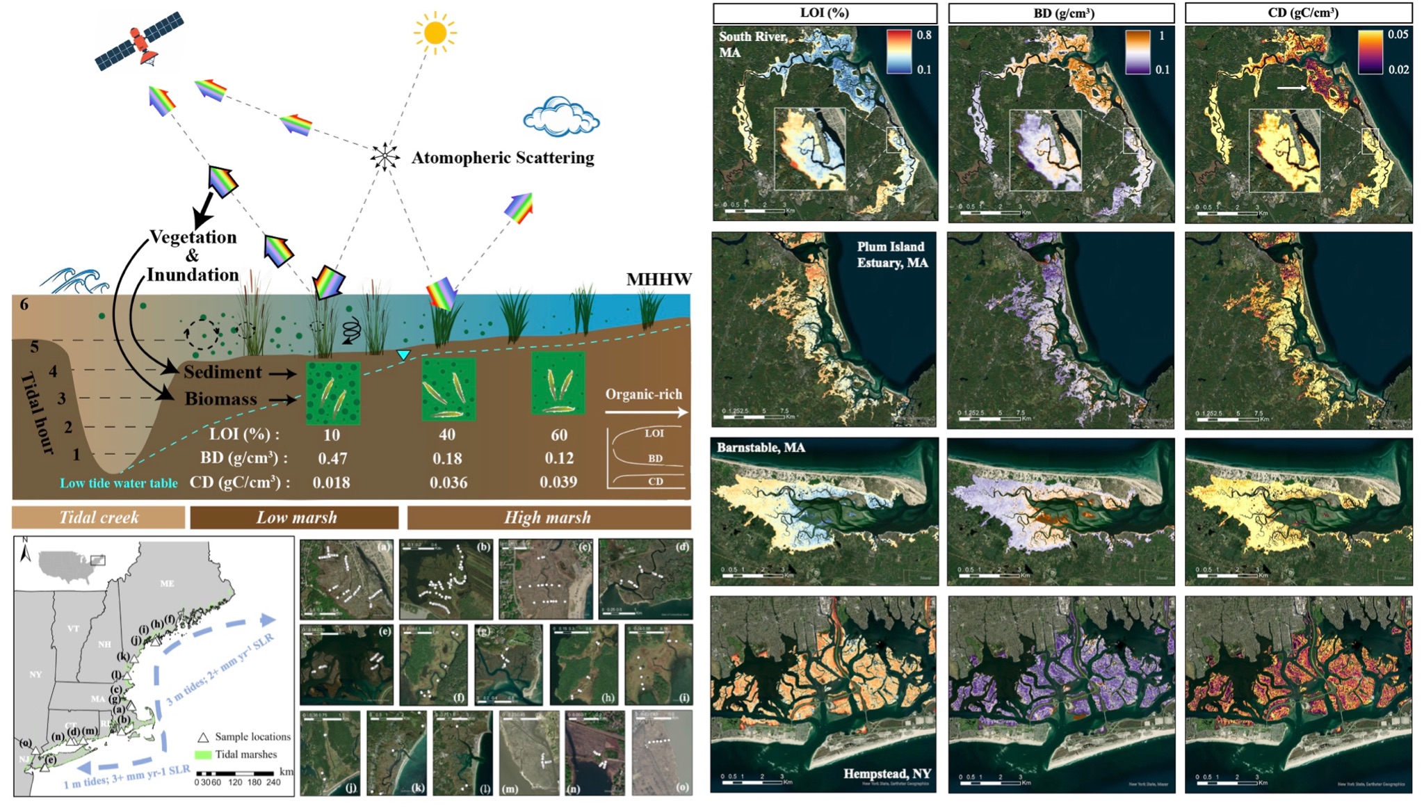
Remote Sensing of tidal marsh
Blue Carbon Mapping in the Northeast US Tidal Marshes Using Satellite Remote Sensing
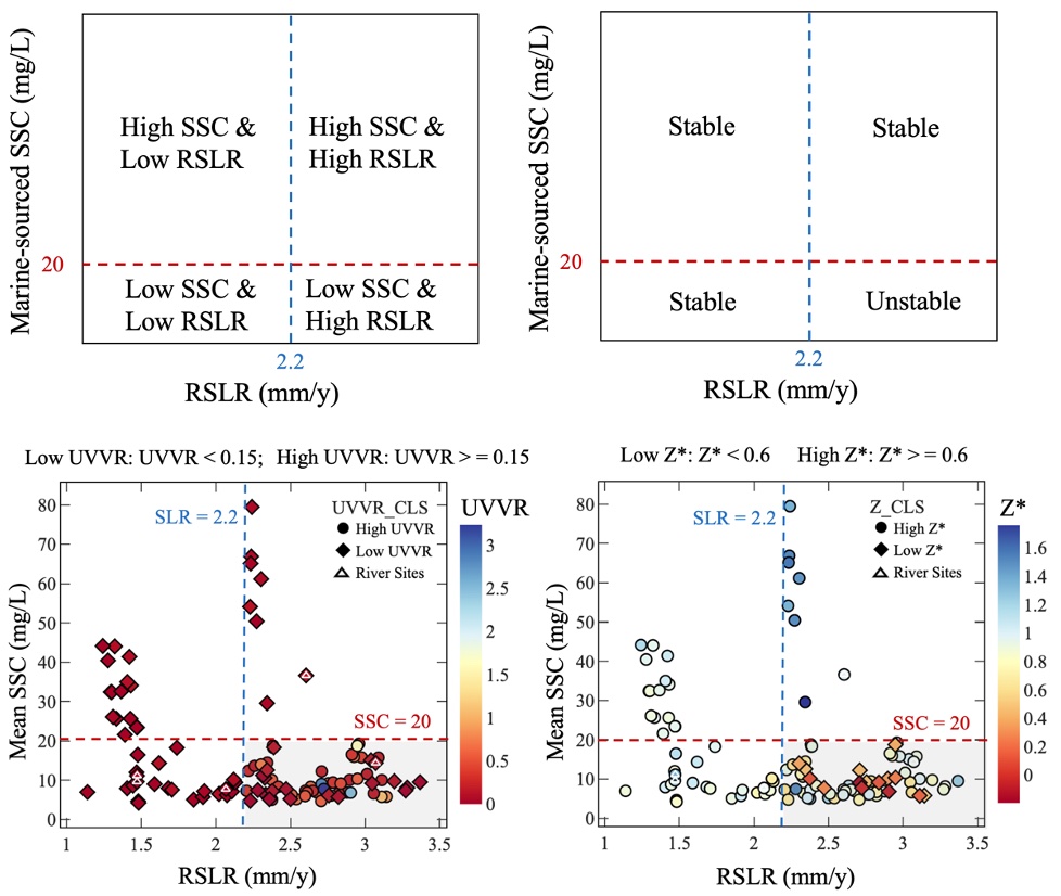
coastal GEOMORPHOLOGY
Marine-Sourced Sediment Supply & Salt Marsh Resilience to Sea Level Rise
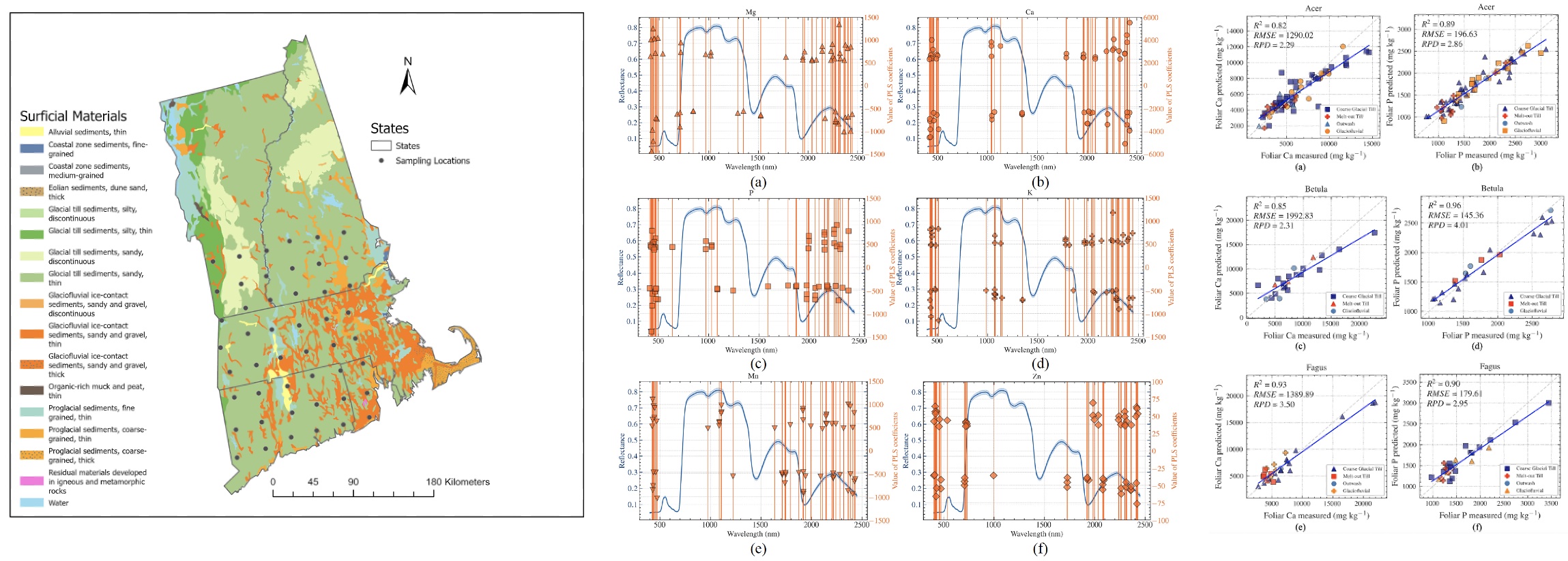
Forestry Remote Sensing
1. Predicting Foliar Nutrient Concentrations Across Geologic Materials and Tree Genera in the New England Using Spectral Reflectance and PLSR Models
...
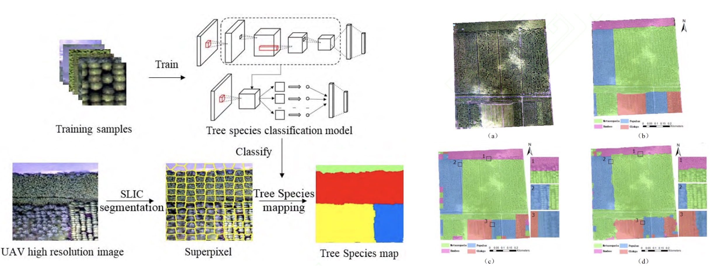
2. Tree Species Classification and Mapping Using Deep Transfer Learning With Unmanned Aerial Vehicle (UAV) High Resolution Image
...
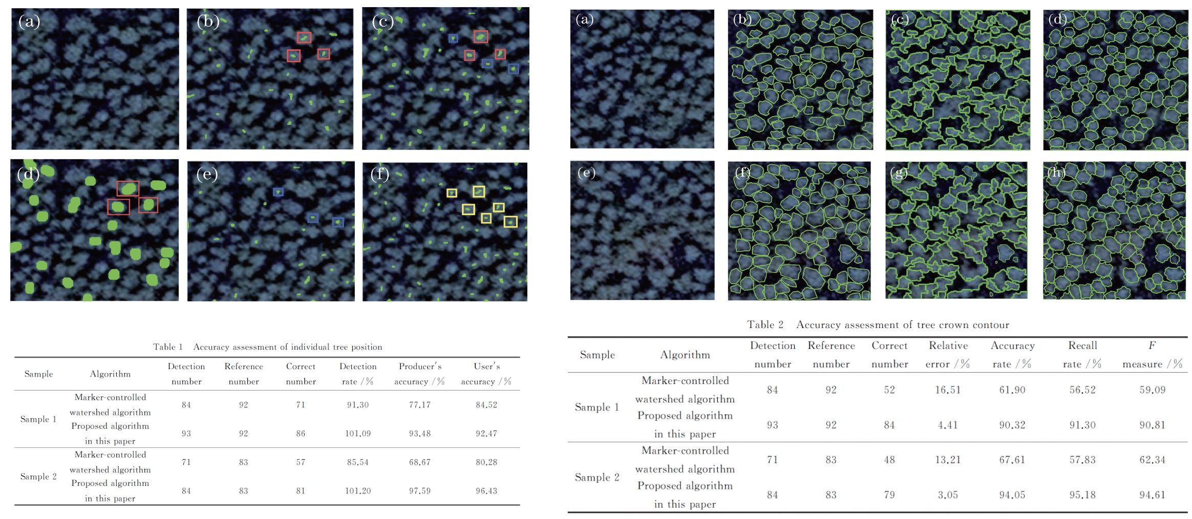
3. Individual Tree Crown Delineation in High Resolution Remote Sensing Image Based on Iterative H-minima Improved Watershed Algorithm
...
Remote Sensing of Land Cover / Land use
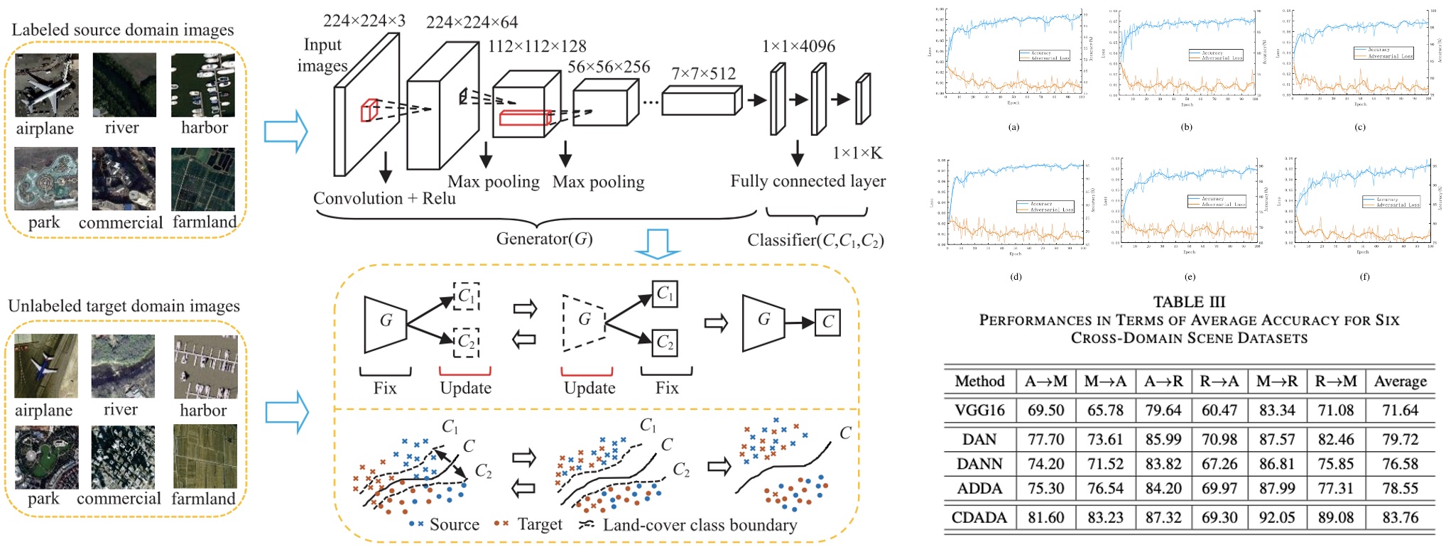
1. Classifier-Constrained Deep Adversarial Domain Adaptation for Cross-Domain Classification in Remote Sensing Images
...